Topic/Objective
The 45° imaging is no longer displayed in Google Maps due to changes made in the CAD Mapping.
Scope/Context
Google Maps API is changing, and it will impact the satellite views of the CAD Map in Ally and Allygov.
Only some zoomed-in satellite views will be impacted, as not all Google Maps satellite views show the 45° view.
Background/Details
The change will be released by Google in August 2025. At that time, Google Maps API satellite maps will no longer automatically switch to 45° Imagery at higher zoom levels. Where 45° Imagery is available, the map will show the top-down satellite view even as the user zooms in. This will impact Ally satellite views on the CAD map.
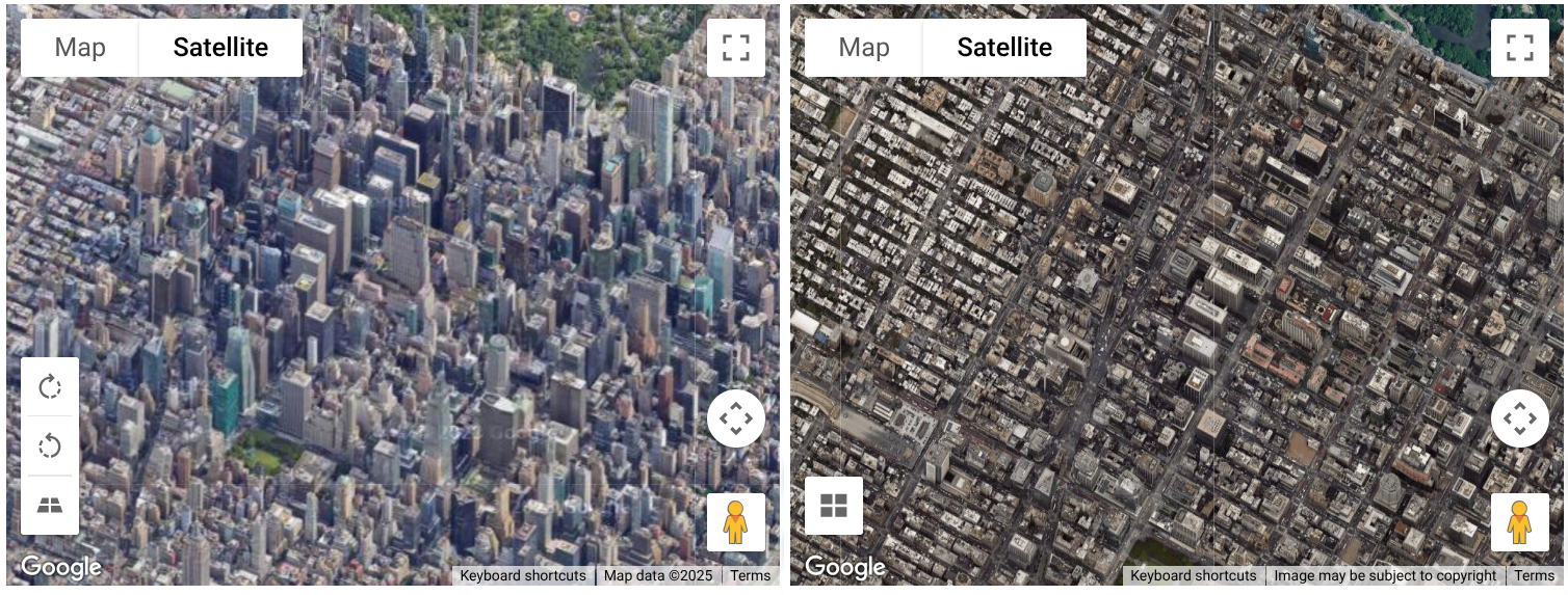
45° Imagery provides an aerial view of the world, where objects are viewed at an angle, giving an additional perspective (in certain locations only). The example below is a 45° Imagery on the left (current when available) vs. top-down imagery on the right (how it will look after the change in August):
When available, 45° Imagery is displayed automatically when the user zooms to a certain level.
Based on feedback and usage patterns, Google is deprecating the use of 45-degree imagery in the Google Maps JavaScript API. Customer needs for visualizing the world are increasingly met through other modern mapping approaches.
The specific functionalities and perspectives offered by 45° imagery no longer fit the use cases of most of their customers.
Outcome/Recommendation
There are no resolutions are workarounds at this time. Moving forward, Google Maps satellite view will only display the top-down view.
The change will be released in August 2025; at that time, Google Maps API satellite maps will no longer automatically switch to 45° Imagery at higher zoom levels. The satellite map will always display the top-down view after the change in August 2025.